|
 |
 |
| |
|
|
Landing, New Jersey Historical Photos
Text by M. Balston, Website Editor
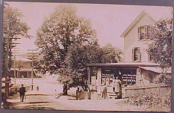
Postcard above is
Landing circa 1895-1903.
This original Rail Station was about 75 yards west of the current one.
At the top of the photo, the building at far left is the rear of the
King Brothers Grocery Store,
the
center building is King's Ice Cream & Confectionery, the building
at
right is the Post Office.
This view looks northeast. (This postcard is a hand-colored black
& white
photo)
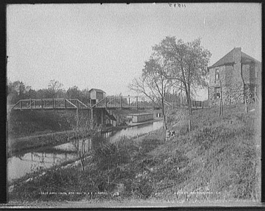
Landing circa 1895, bridge
over the Railroad and Morris Canal. In 1908 a masonry bridge
replaced this and is still in use today. The octagonal stone building
was the
site of the Post Office
at that time, later a Real Estate office. The building was demolished
and the
site is now the Parking Lot
of an office building. This view looks southwest.
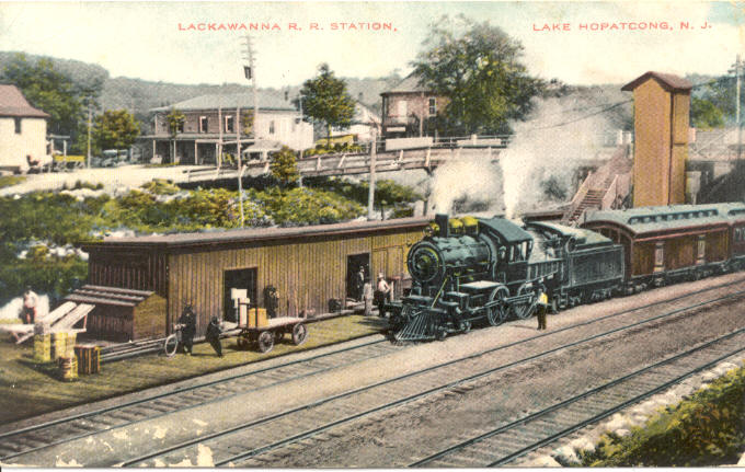
Landing Rail Station and
Morris Canal, circa 1895-1905 with a "Black Line" boat dropping off
passengers.
This section of the Canal was filled in and is now a parking area.
This view
looks West.
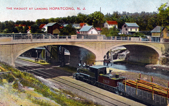
Many forms of
Transportation can be seen in this circa 1910 hand colored photo:
The Tracks and Train of the Lackawanna Railway, the Morris Canal
waterway, the
recently completed
Landing masonry bridge which
carried Automobiles, Horse-drawn carriages and the
Trolley tracks of the Morris County Traction Company. This view
looks northwest.
The old Landing
RR Station is partially seen under the left arch.
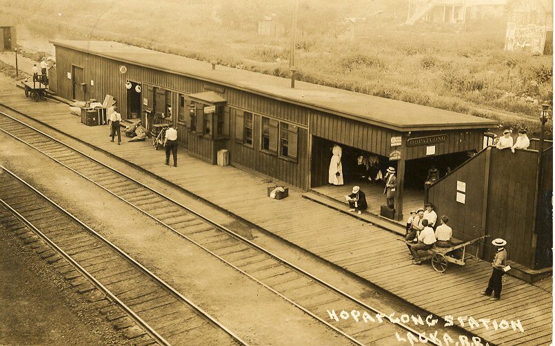
The "old" Lackawanna
Railroad Station at Landing, circa 1908-1910, about 75 yards west of
the current
platform.
This station was on the north side of the tracks. Its waiting room had
a stand that sold newspapers, candy, and souvenir postcards
like this one. In
this image there are several smaller scenes; at right the well-dressed
"Dandy" is being eyed by the two Ladies
above him on the stairs, the
older Porter is giving his young
audience an earful, businessmen
and salesmen wait for trains.
During this era,
trains ran frequently
as they were the main transportation between cities and few people had
cars.
Today legal
professionals can work on legal
software case management from their laptops during their
commute.
Traveling by train offers a great opportunity for lawyers
to prepare for upcoming legal cases.
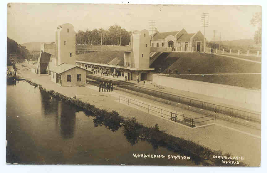
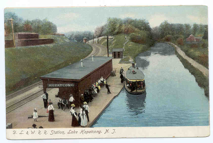
The "New" Railway
Platform and Building, 1911. The current platform occupies the same
area.
This Morris Canal section is now filled in and is a parking area. The
pedestrian
bridge and
towers were removed years ago.
The Station house seen at top right still stands
and has
been used as offices and a retail store in recent years.
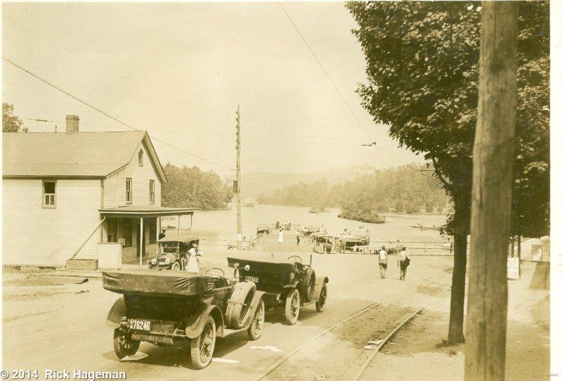
We recently received this personal family photo from
Rick Hageman, taken by his Grandfather Carl D. Hageman circa 1916.
Rick writes: "My grandfather, his girlfriend (later becoming my
grandmother), and some childhood friends were frequent visitors to
the area.
The parties were members of the
Easton PA Canoe Club and made frequent canoe trips on the canal
systems at Easton and the
adjoining areas, including Lake Hopatcong". This view looks
north to the lake from the area of today's traffic light, note the
Trolley tracks.
At the time, the building at left was the Post Office & Grocery
Store.
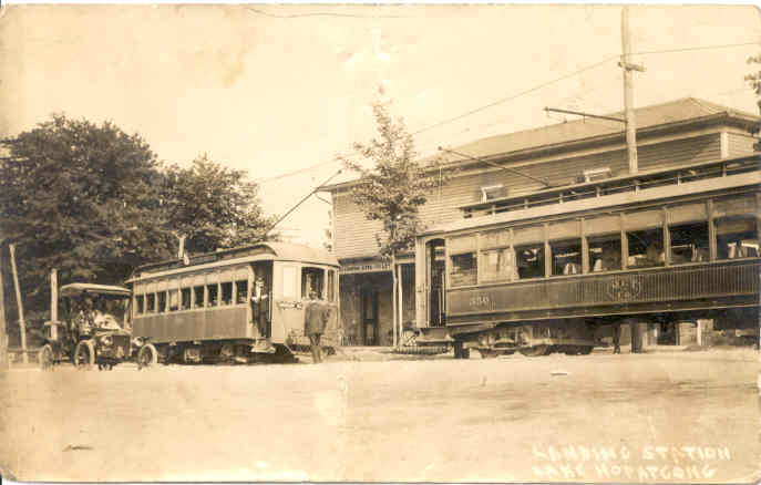
Morris County
Traction Company trolleys at Landing circa 1910, area of today's
traffic light. The building behind the
Trolleys
eventually became the site of a Repair Garage, then a Realtors
Office after much
modification. The Lake is at left, out of view.
|
|
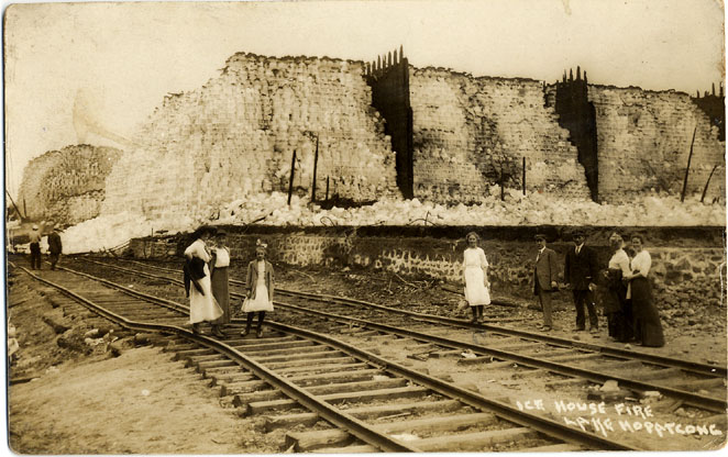
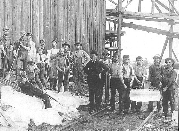
On July 12, 1912 the huge
wooden ice storage building of the Mountain Ice Co. burned to the
ground in
a fire
so large the flames lit up the sky all around the Lake. The dark areas
on the
ice are the ashes from the fire.
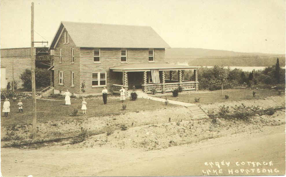 The "Carey Cottage", circa 1914, with the 'new' Ice House behind it. This house is on Mt. Arlington Blvd. just about 50 yards north of today's Nixon Public School. It was originally built in the 1880's and in it's earlier years is said to have been a part-time residence for the King brothers as they supervised their business interests in Mining, Real Estate, their Retail Stores and Ice Harvesting, all in and around Landing. King's Mountain Ice Company was at this site. This huge operation employed large numbers who cut ice blocks on the Lake in the winter, storing them in a mammoth wooden insulated storage hanger, and shipping the ice out by canal and rail to fill the iceboxes of city dwellers in warm weather. In July 1912 the wooden hanger burned to the ground in a fire so large the flames lit up the sky all around the Lake. In 1913 an even bigger storage building was built in a fireproof construction of steel and hollow ceramic tile with insulating properties. The "Carey Cottage" served as a residence for the family of the Ice House Supervisor, John Carey, his wife Mary and children and appears to have been refurbished in 1913 with the same tile exterior as the Ice House. At the time of it's construction, it's 56 foot height made it the largest Ice House in America. It was said to be able to hold 100,00 tons of ice. It was the largest single-span construction in the USA until Radio City Music Hall was built. The "new" ice house is visible in this photo behind the house. Ramps stretched down to the lake to bring the ice up. In this photo, the Supervisors house had just been sheathed with the tile. Note the Trolley tracks in front and the wooden pole holding the overhead trolley electric line. With the advent of electric refrigeration, the ice house closed in 1935 and was torn down in 1939. The 'Carey' house, at 285 Mt. Arlington Blvd., still stands, just north of Nixon Elementary School. Note the view above, Bertrand Island is at upper right. The Camera must have been on a high platform to intentionally "shoot over" the tree line to be able to show the Lake. (Photo Courtesy of the Lake Hopatcong Historical Museum) |
|
Our friends at the Lake Hopatcong Historical Museum sent us these rare Landing photos: |
| Today's
Lakeside Boulevard looking south towards Landing Center. (note Landing bridge at right, trolley in background, horse cart) (circa 1912) Courtesy of the Lake Hopatcong Historical Museum |
 |
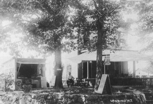 |
Flowers Store, Landing (circa 1910) Lakeside Boulevard This store had an outdoor eating area in the summer. Courtesy of the Lake Hopatcong Historical Museum |
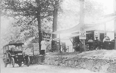 |
Flowers Store, Landing (circa 1910) Lakeside Boulevard The signs advertise Sandwiches, Coffee, Tea, Milk, Grape Juice, Fruit Sundaes, Cigars, Cigarettes and Viedt's Ice Cream. Courtesy of the Lake Hopatcong Historical Museum |
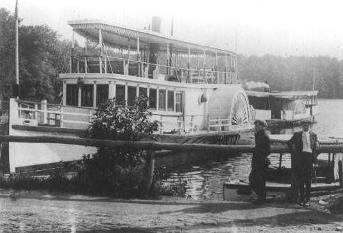
White Line steamer "Hopatcong" at Landing Dock (circa 1905) Courtesy of the Lake Hopatcong Historical Museum |
 |
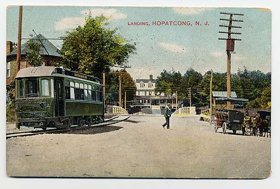 |
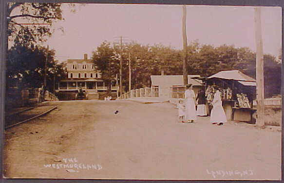
Looking south over the "new" Landing Bridge, circa 1908. Behind the camera is Lake Hopatcong, the building across the bridge is the Westmoreland Hotel, no longer standing, near the site of today's "Station Hardware". The trolley is from the Morris County Traction Company, whose line ran from Morristown, through Dover, over the Landing Bridge and then, by 1910, onto Bertrand's Island. |
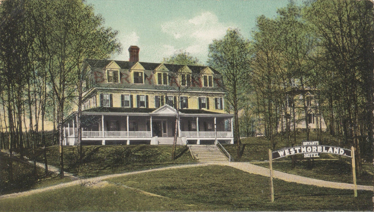
The front of the Westmoreland Hotel in Landing NJ, circa 1907. The
Bryant family operated the hotel,
which was located about 50 yards behind the current 'Station Hardware'
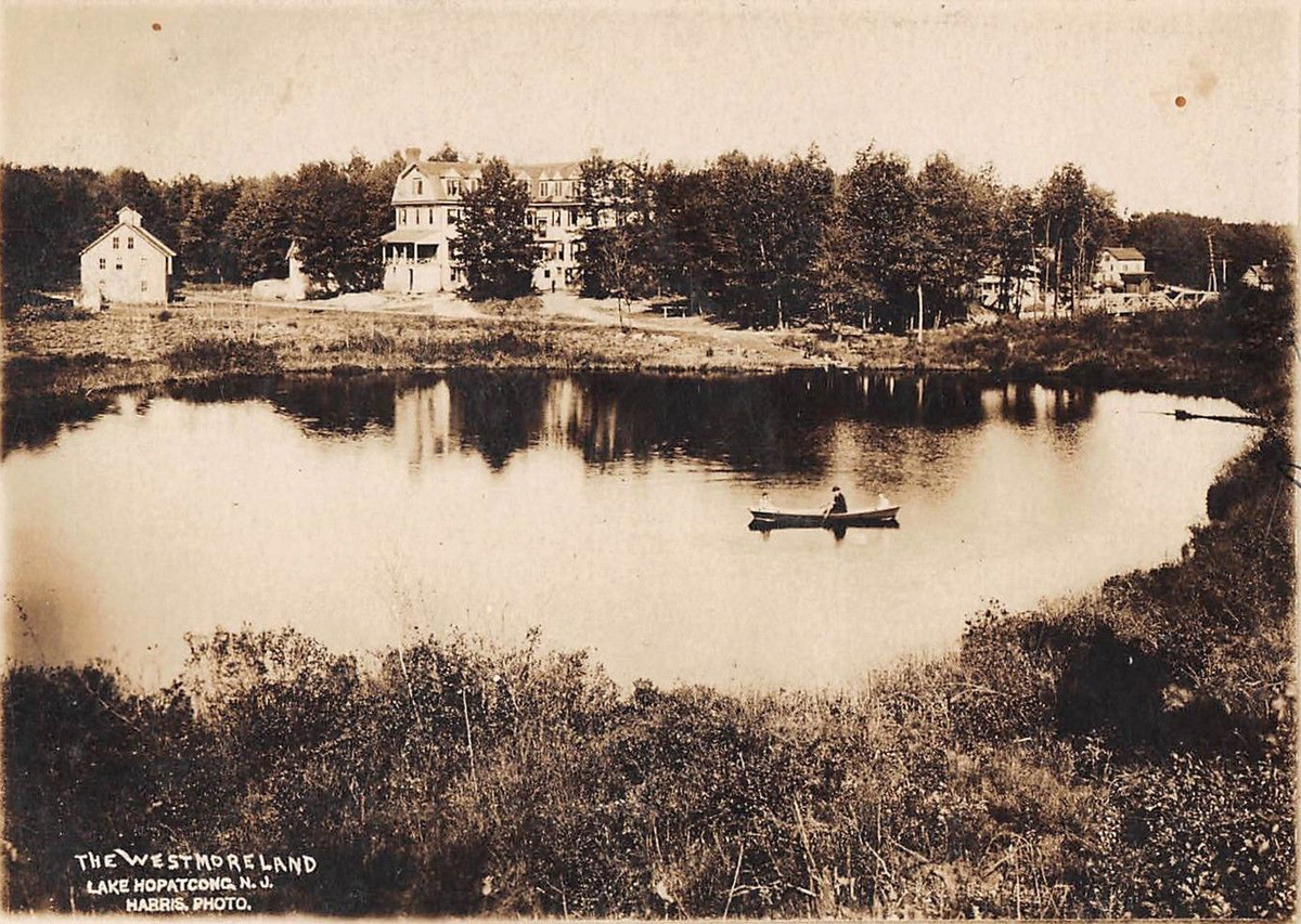
The back of the Westmoreland Hotel, circa 1907, with a pond that
still exists to the west of Landing Road.
The area of the Landing bridge is at upper right.
The following 'Sepia-Toned'
photos were
sent by John DeBellis, Thanks John !!
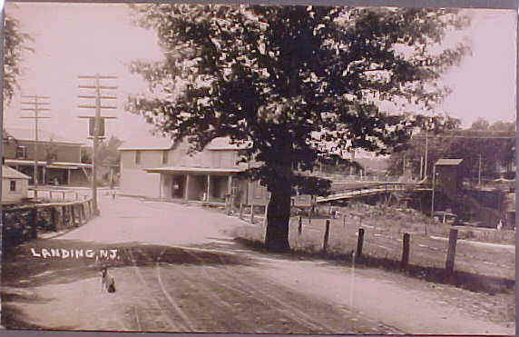
Lakeside Boulevard looking south towards
Landing Center. Building at right is the John
Arendagzky
Grocery and still stands at 109 Lakeside Blvd., today's Lakeview Deli.
(Could
that be Theo. King at left ?!!)
This view is a few feet further down
Lakeside Blvd. from the photo above. This photo
is significant in that it appears to have been taken during the short
period
after
the "new" Landing Bridge was built but before the old one was removed,
c. 1911.
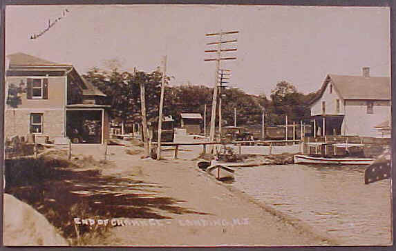
The end of Lake Hopatcong in Landing,
looking south. The Camera position is
near today's "Lake's End" Marina.
Looking south over the "new"
Landing Bridge, circa 1912. Behind the camera is Lake Hopatcong,
the building across the bridge is the Westmoreland Hotel. Dorastus L.
Bryant
and a group of investors
built the Hotel circa 1890. When first built, it was called the
'Lake End
Hotel' and renamed the
'Westmoreland' in 1897. It's Restaurant and Banquet Hall was highly
regarded.
During World War One,
the nearby Atlas Powder Co. geared up to produce large quantities of
munitions
for the Army. Atlas housed
its' new workers at the Hotel. After the War, the Hotel was renamed
the
'Monticello'. The Hotel burned
down in 1922, it's near the site of today's "Station Hardware".
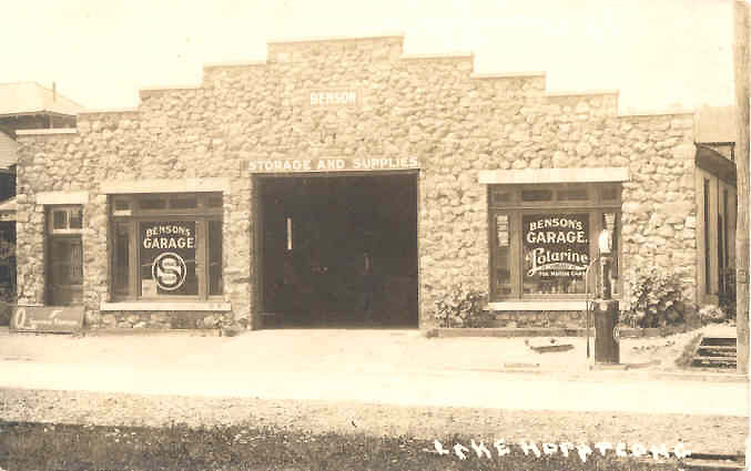
After the demise of the Westmoreland Hotel, several
buildings
sprung up along heavily traveled
Landing Road. To service the growing number of Automobiles, Benson's
Garage
opened in the 1920's,
it's site is today's Landing Gulf Gas station.
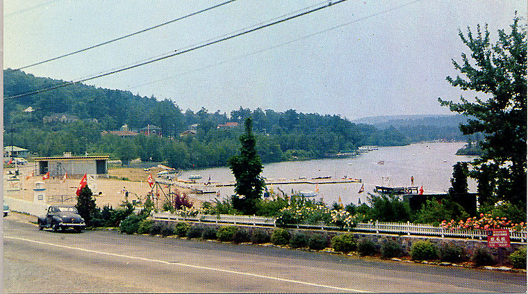
In the 1950's "Shore Hills Estates" was a Real Estate venture that
built dozens of homes in the hills of Landing.
Part of the marketing was the offer of membership in "Shore Hills
Beach
& Country Club", shown in this
circa 1957 postcard. The Developer, S & S Construction / Manny
Selengut had
an office just out of the
photo at right, however their sign is visible. A few years later
Chaplin Homes
would construct here as well.
| This page can only begin to cover the rich history of Landing. While this Landing history page is an independent effort, we recommend a visit to the The Lake Hopatcong Historical Museum at the State Park, open Sunday afternoons in the Spring and Fall. Admission is free, donations accepted. |
If
you know Landing history and can add to or
correct this page,
you can e-mail the Editor at: Editor @
LandingNewJersey.com
(just remove the spaces, an anti-spam measure)
Click here to Return
to main page
Landing, New Jersey is part
of the
Municipality of Roxbury Township. A link to the "official"
website of Roxbury Township can be found on our "Links" page.