
|
 |

|
|
|
|
|
Landing, New Jersey Maps & Aerial Photos
Aerials - Photos & Maps |Online Reviews - Home Advisor Reviews |Home Advisor - Linkedin |Home Advisor - Wikipedia |NJ Maps - Traffic Advisor
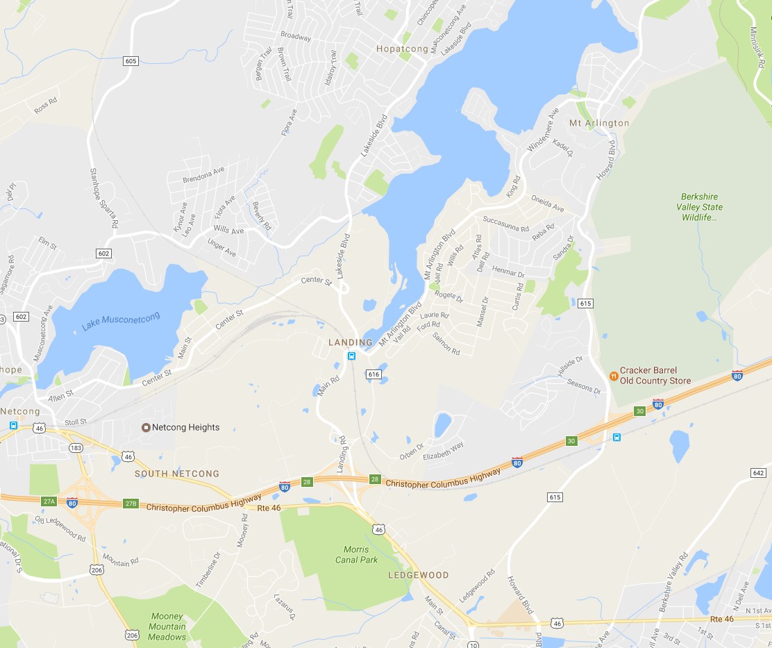
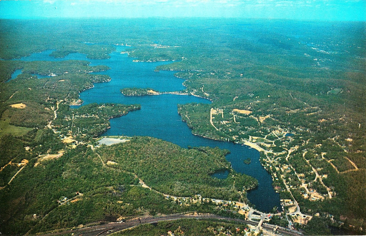
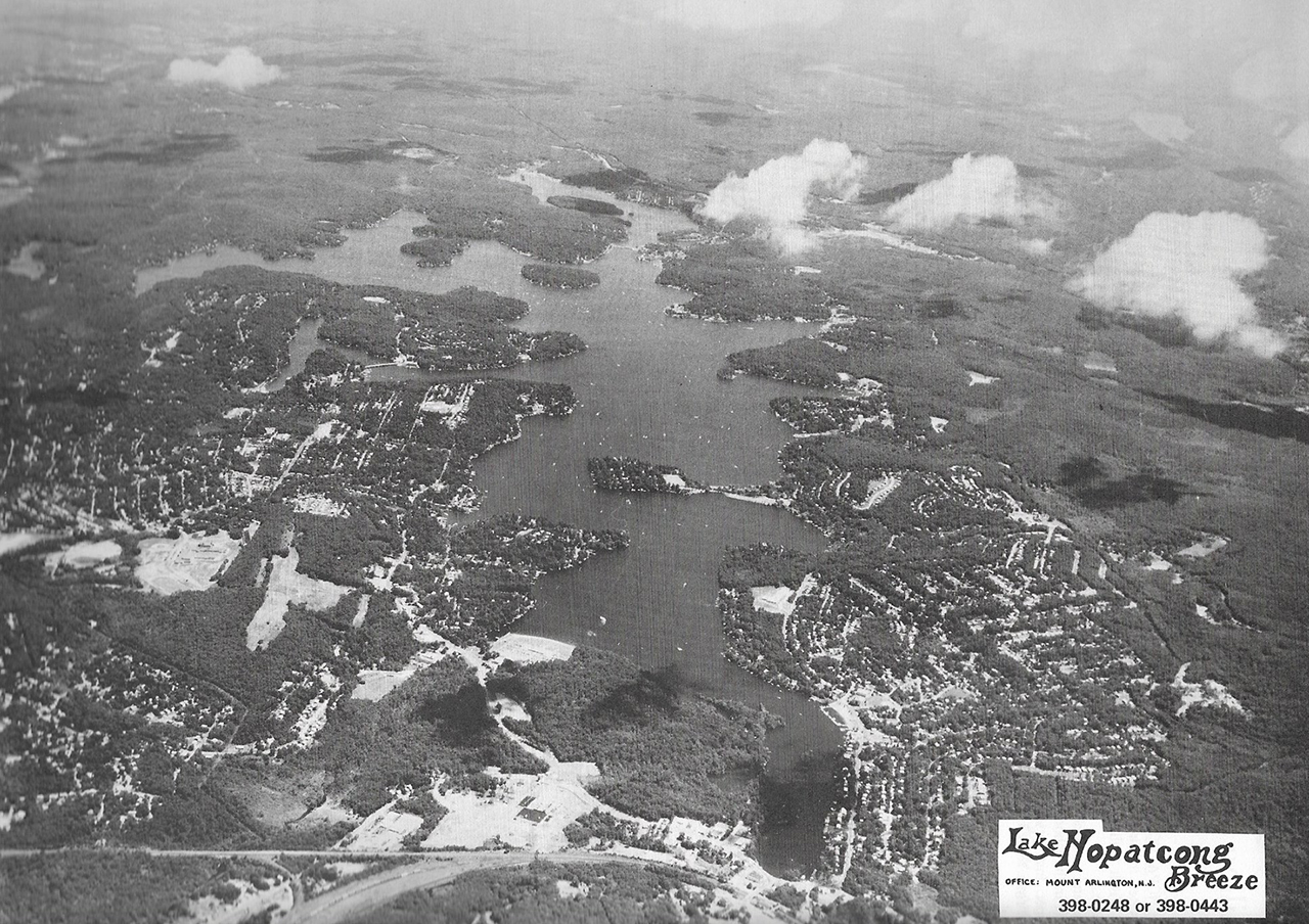
Wide Overview. I-80 goes from right to left along the bottom, Lake Hopatcong in
the middle
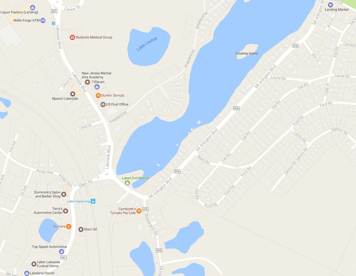
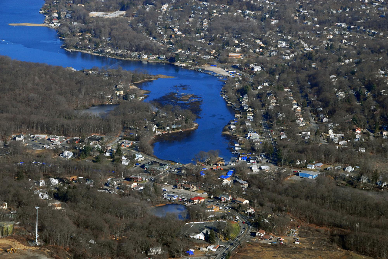
Close-up of Landing Bridge area, Business District and south end of Lake
Hopatcong
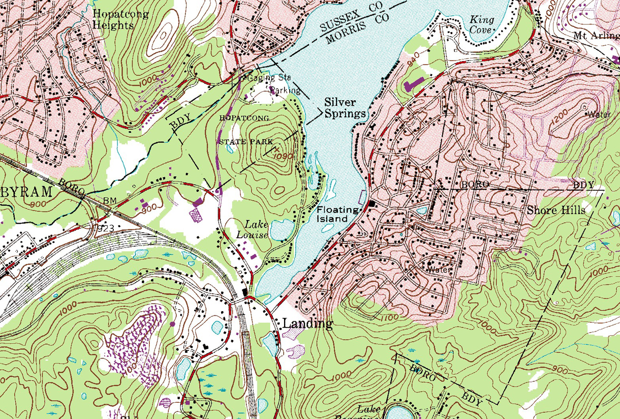
US Topographical map of Landing, last updated 1981
Aerial view of Landing in 1963. The Shopping Center
& Nixon School not
yet built, some streets unpaved
Aerial view of Landing in 1976. The Shopping Center and Nixon School
are there.
Aerial view of Landing in Winter, 2022
| The Zig-Zag
Border of Landing & Mt. Arlington Here's the zig-zag boundary line between Landing, part of Roxbury Township, in the lighter color, and Mount Arlington, in the darker color. The seemingly irrational borders can be traced back to 1890, when a few districts voted to secede from Roxbury, and others didn't. Nevertheless, some streets in Mt. Arlington have Landing, NJ 07850 addresses. |
 |
This is www.LandingNewJersey.com - Click here to Return to main page
-
This page is a voluntary service of LandingNewJersey.com, a privately owned
website. Landing New Jersey is part
of the Municipality of Roxbury Township. A link to the "official"
Township website can be found on our "Links" page.