
|  |

|
|
| |
|
|
A Port
Morris historic photo album by Barbara Carmean Dickisson. On another
page of this website, we presented Barbara's personal family photo album
and story of growing up in Port Morris
from the 1940's thru the 1980's. We scanned those photos, and also her
historic Port Morris town photos and newspaper articles, most of which
appear online for the first time. The photos and articles are roughly
chronological order. |
|
A PORT MORRIS, NEW JERSEY HISTORIC PHOTO ALBUM |
Older photos scanned by the Editor from the album originally owned by Lydia Hoffman Force, given to Barbara Carmean Dickisson:
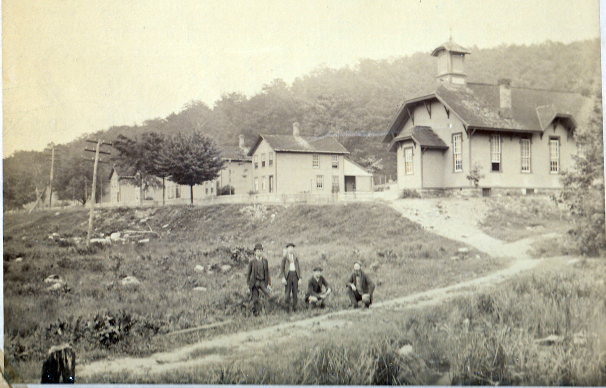
Port Morris New Jersey, circa 1887, showing row of 12
Railroad employee houses on Kings Highway, built in 1873, also known as 'Red Row', or the "'12 Apostles',
with
the
Port Morris Methodist Church at right in its' original location. In 1900 the
church was moved off this site 300 yards across the rails to its'
current site.
Men in photo from left: Man in Bowler Hat is unknown, Man in 'Pork Pie' hat is
Bill Mowery, young man kneeling is Alan Burt, his father is George Burt with
beard.
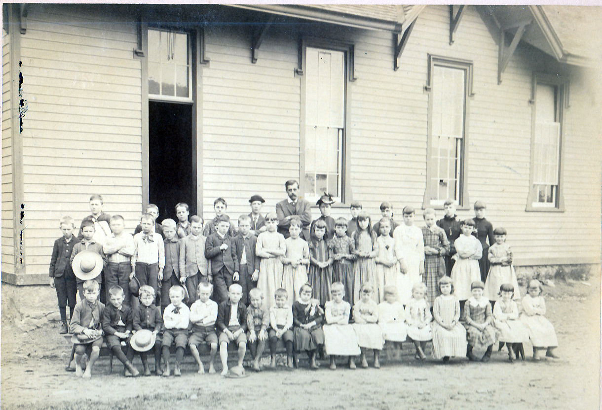
Between 1887 and 1892 the old Methodist Church location
was also where Public School classes were held. It is unknown whether this photo
is a
Sunday School class or a Public School class. In the 2nd row, the girl 7th from
right in a flower yoked dress is Lydia Hoffman. She would go on to marry
Charles E. Force, prominent in Port Morris, this was her photo, handed down to
Barbara Dickisson. Bill Mowery is the teen in a hat left of the teacher.
Bill Sholer is 2nd row, 4th from left.
A small mystery is the length of the window at left when compared to the photo
above.
Was someone later blacked out in the photo and the window extended? Ideas??
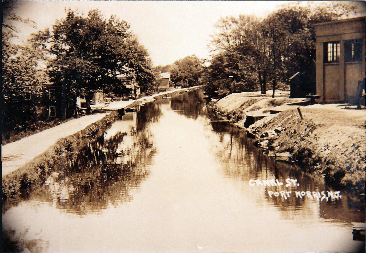
The Morris Canal as it went through Port Morris, circa
1905. The 'towpath' on which mules or horses would walk is at left, they pulled
boat barges loaded with
raw materials. The 'hayday' of the Canal was 1840 thru 1890, by 1905 most
traffic shifted to the railroad. The back of the Railway 'Roundhouse' is seen at right.
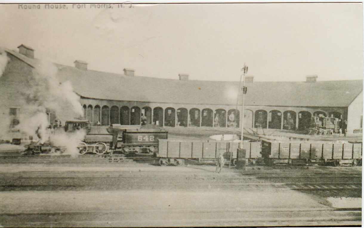
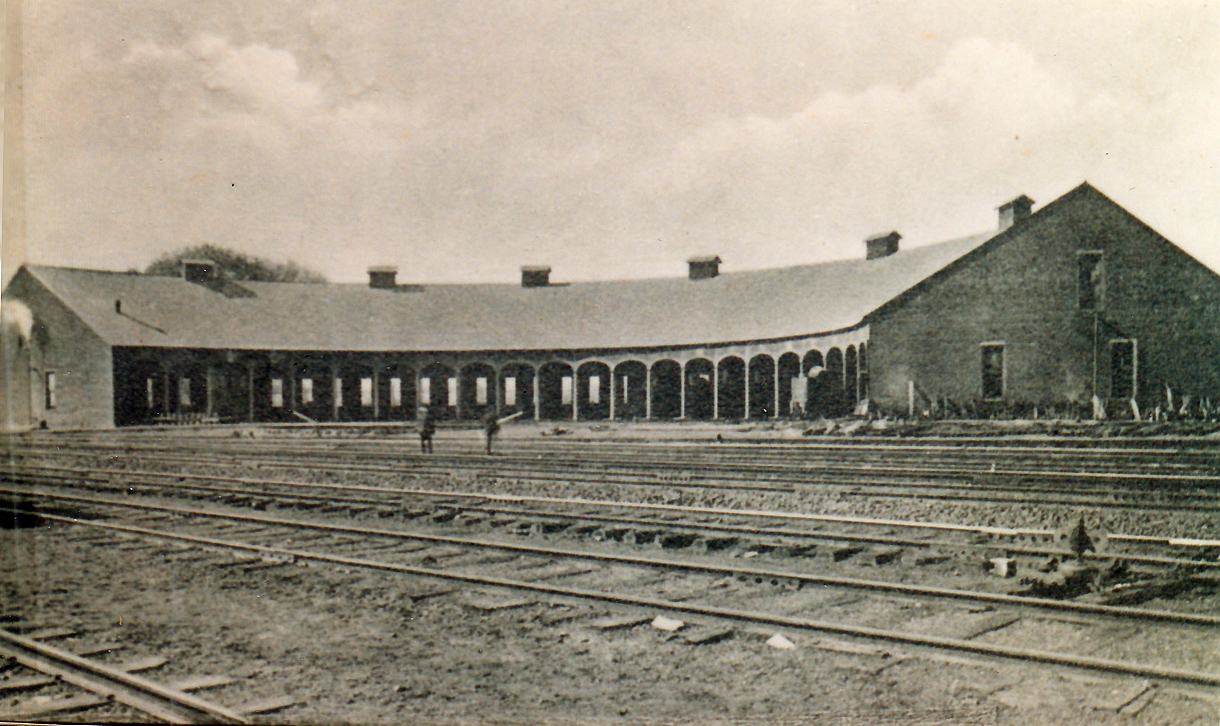
An early photo of the Port Morris Railway
Engine 'Roundhouse, circa 1890, the turntable is just right of center.
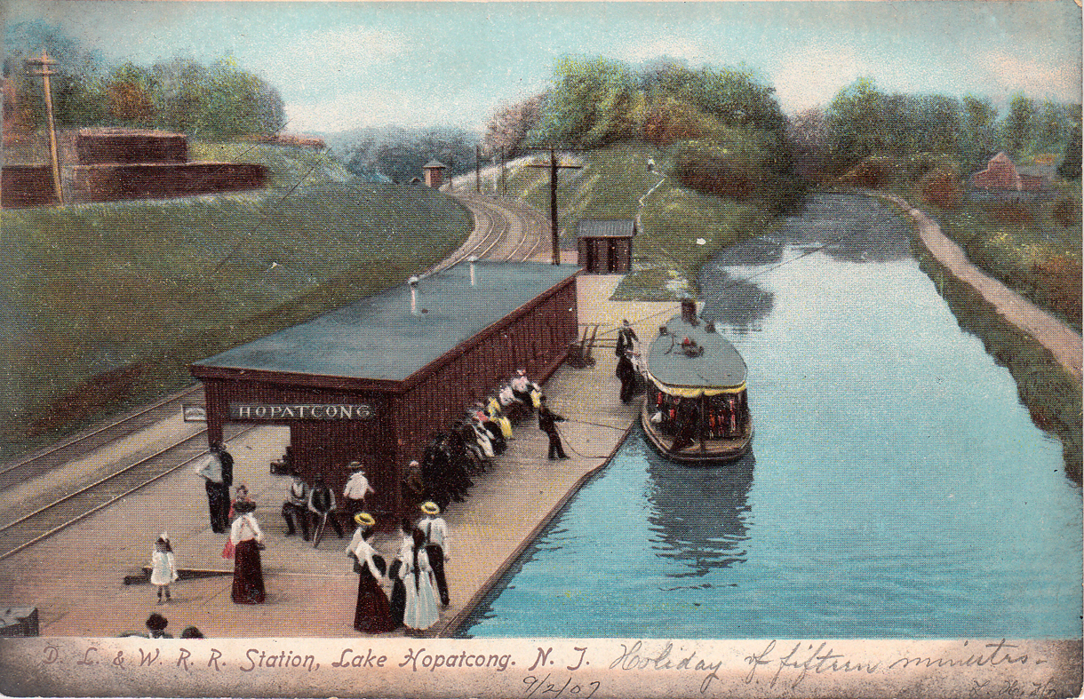
Card from the collection showing the
Delaware, Lackawana & Western Railroad Station at Landing, along with the Morris
Canal with a Black Line shuttle boat.
Vacationers would board trains in the city, go up to Lake Hopatcong, cross the
platform where these boats loaded them and their luggage for the trip thru
the Canal Lock into Lake Hopatcong where all the Hotels had docks. Card was sent
in 1907, but image is circa 1904.
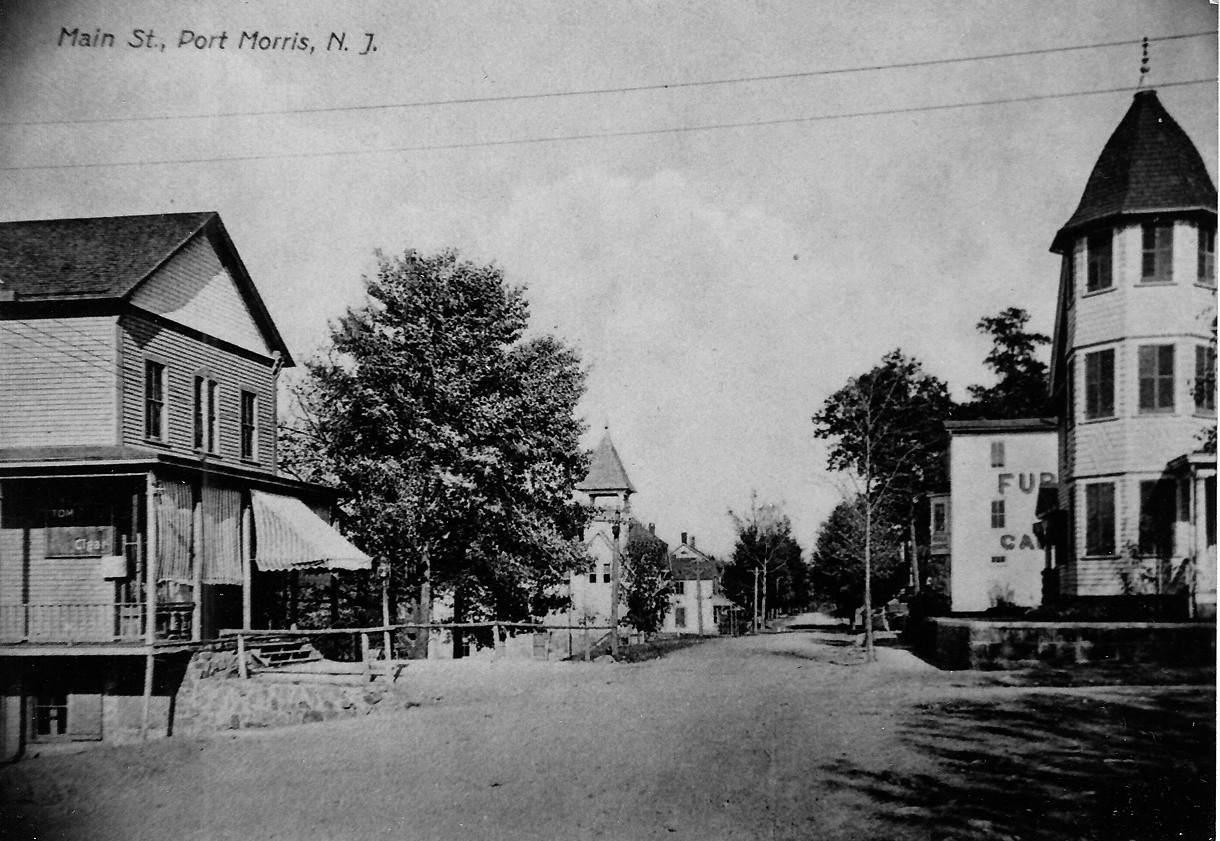
Looking east down Center Street, cor. of Palmer, circa 1904. Over
the years the building at left, 304 Center St, served variously
as Thompson General Store, the 'Red Men' Lodge meeting hall upstairs, Rossi General Store
in later years, the Post Office, Loppy's Barber Shop,
a
Shoemaker downstairs and
at one time Hriszko's -also spelled Risko's Pool Hall upstairs.
(Thanks Bob Waldron for the info!)
The square building (307 Center Street) at right behind the home is the Hulse (later Harding) General Store,
the signage looks like the
start of the
words "FURNITURE" and "CANNED GOODS", items seen in their print ads.
The home at right was built by the Hulse family.
The store building at left burnt down in the late 1960's, the 2
buildings at right still stand.
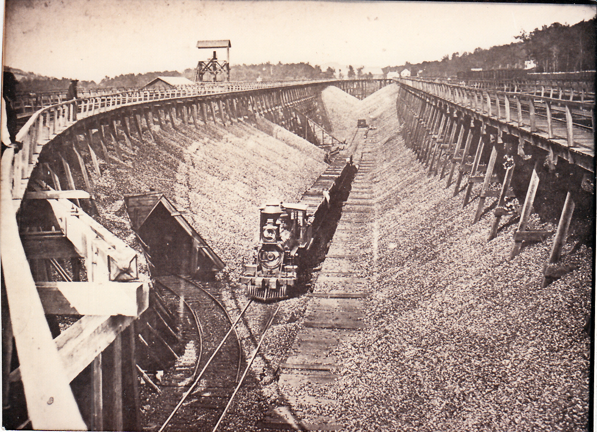
In this circa 1895 photo, a Steam Locomotive moves coal cars at the Port
Morris Transfer station for the loads that came in from the
Pennsylvania
coalfields. Many coal cars had upper bodies that could be tipped, dumping
the coal.
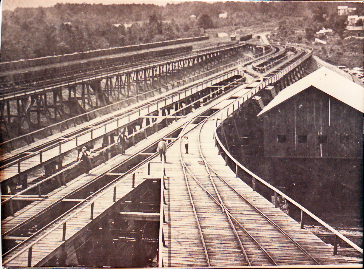
The rail and coal complex at Port Morris
was a major hub.
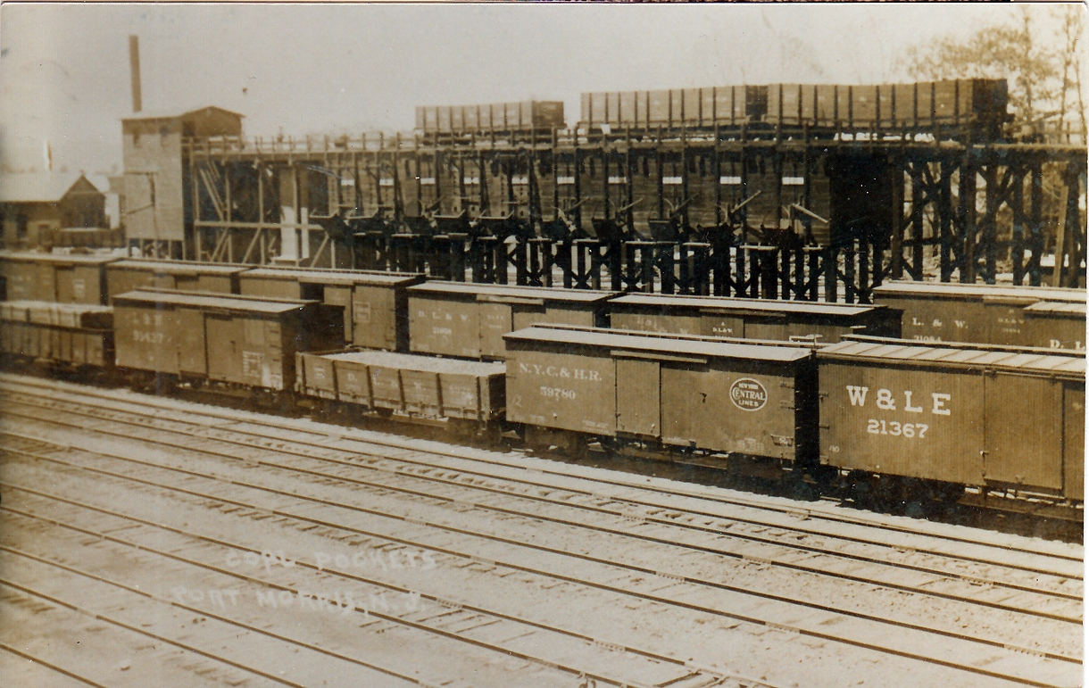
In this circa 1907 image, the "Coal
Pockets" bins are seen.
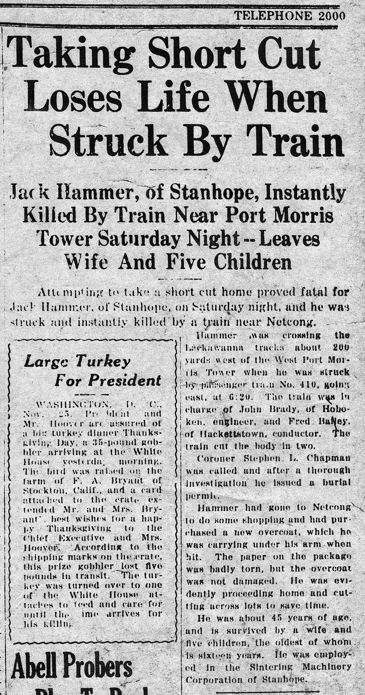
By 1929 the Port Morris railway yard was bursting
with traffic, with passenger and freight trains arriving & departing every hour.
Accidents became common, with the tragedy described above from 1929.
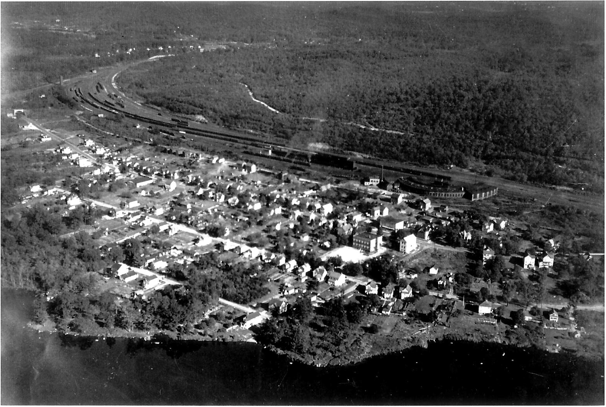
An aerial view of Port Morris, circa
1935-1950. Clearly visible at center right is the Railroad Train Roundhouse.
Lake Musconetcong is at the bottom. Netcong is just out of view to the right,
Landing is at the top left of photo.
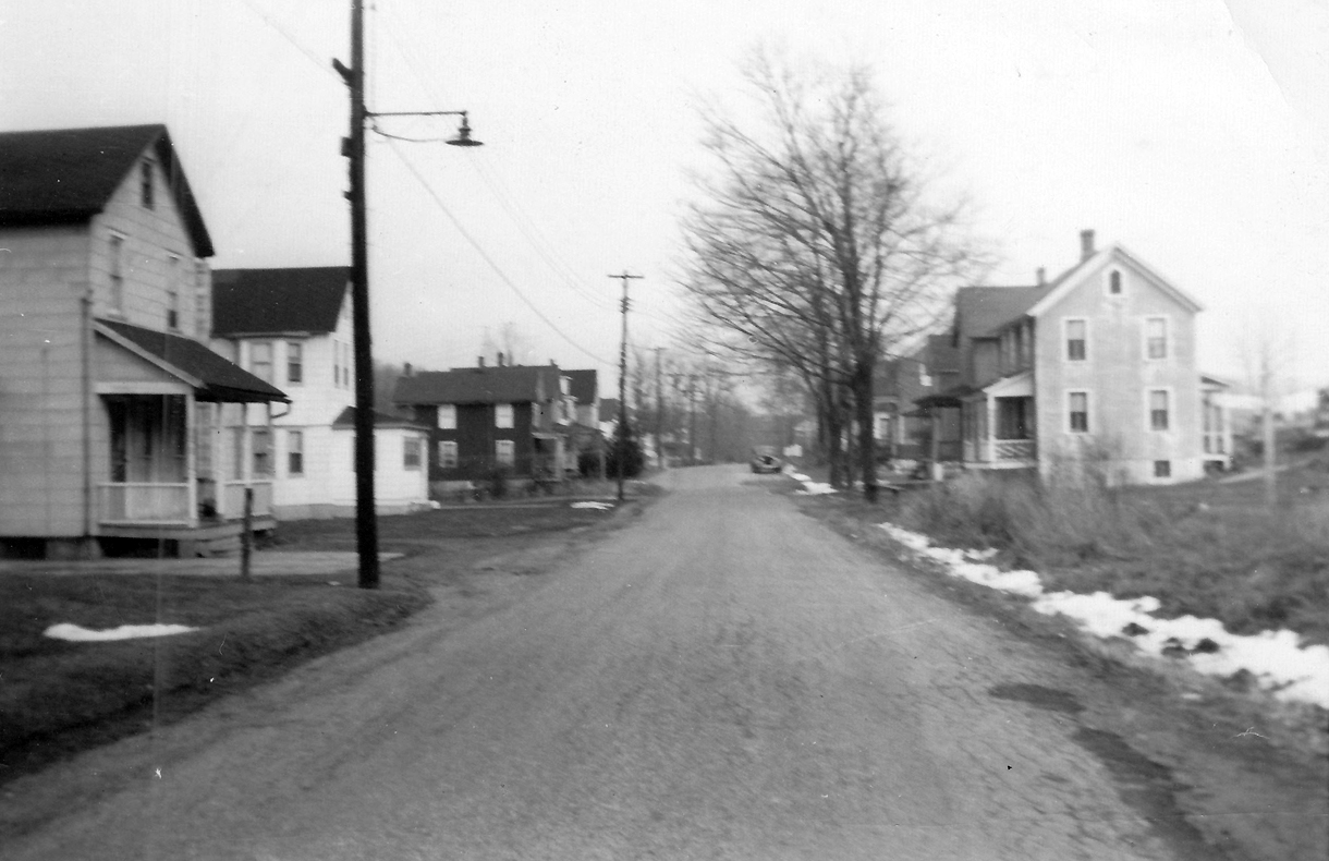
1952 Main Street Port Morris, looking east from
the corner of Palmer toward Davis
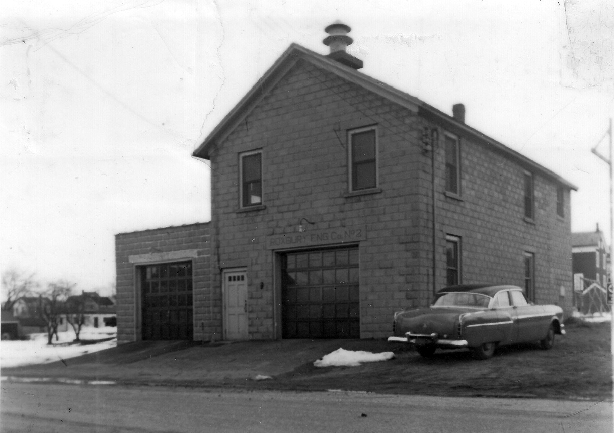
The Port Morris Roxbury Engine No. 2 Fire House,
pictured in 1956 on Main Street
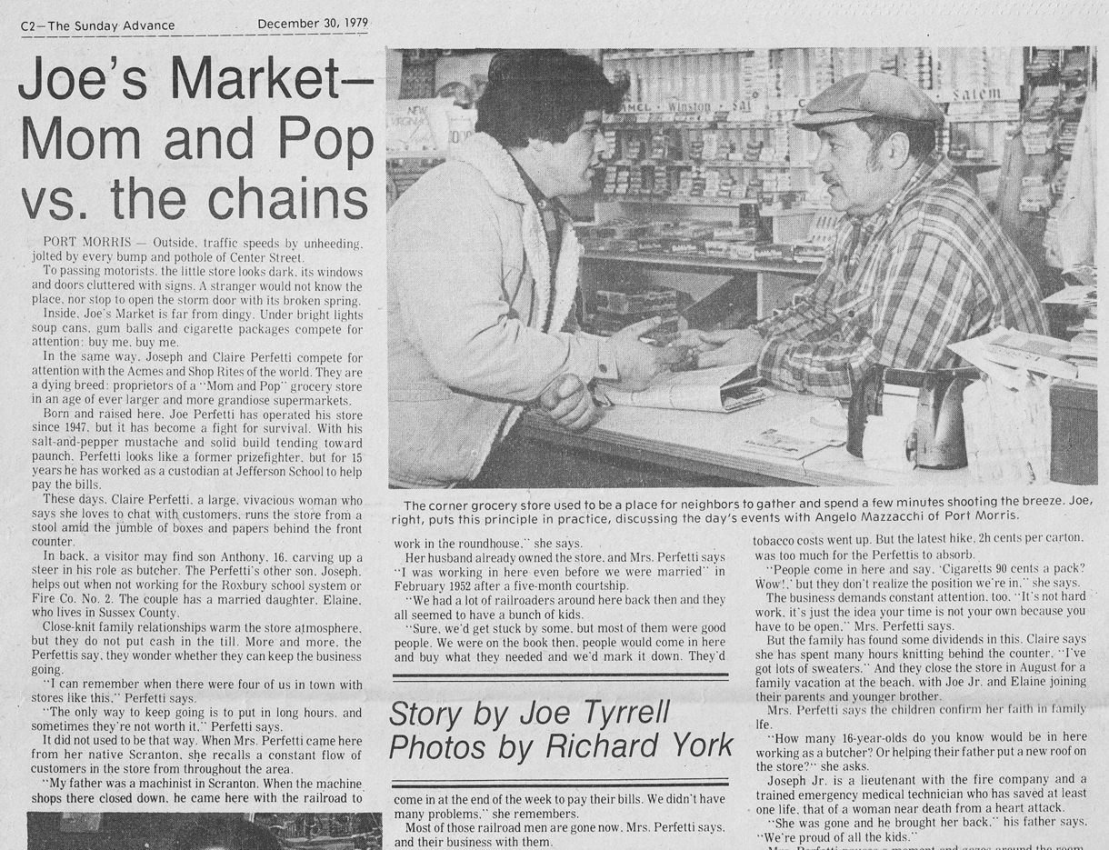
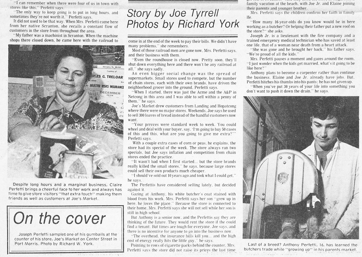
Article from 1979 highlights the small grocery store of
Joe & Claire Perfetti on Center Street, Port Morris, page 2 below
~
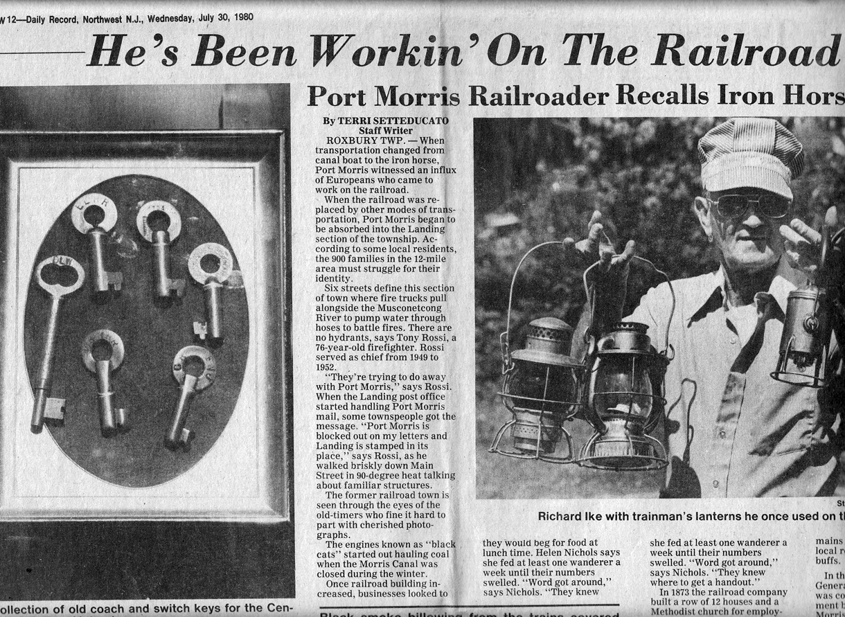
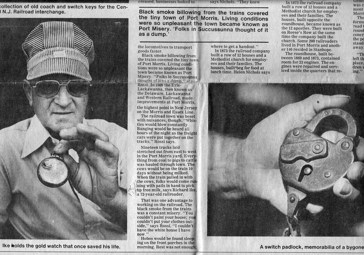
Above and below, an article from 1980
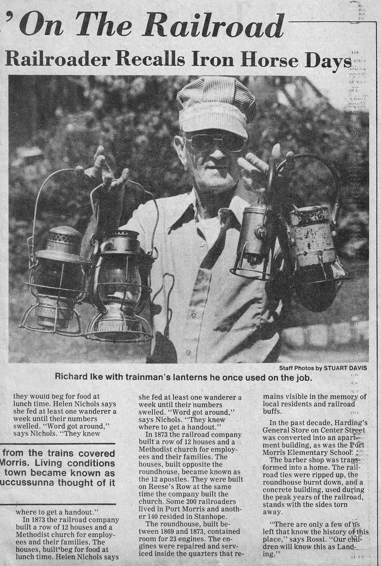
~
Editing &
Page Design by the Website Editor
View our Main Port
Morris History Page
This page can only begin
to cover the rich history of the Landing/Port Morris area. While this page is an
independent effort,
we recommend a visit to The
Lake Hopatcong Historical Museum
at the State Park,
open Sunday afternoons in the Spring and Fall.
Click here
to
Return to main page
-
This page is a voluntary service of LandingNewJersey.com. Revised July 6, 2017